Time series correction method of vegetation index of high resolution remote sensing image based on MODIS remote sensing image
A technology of time series and remote sensing images, applied in the field of geographic information systems, can solve problems such as unadjustable and unstable HJNDVI time series
- Summary
- Abstract
- Description
- Claims
- Application Information
AI Technical Summary
Problems solved by technology
Method used
Image

Examples
Embodiment
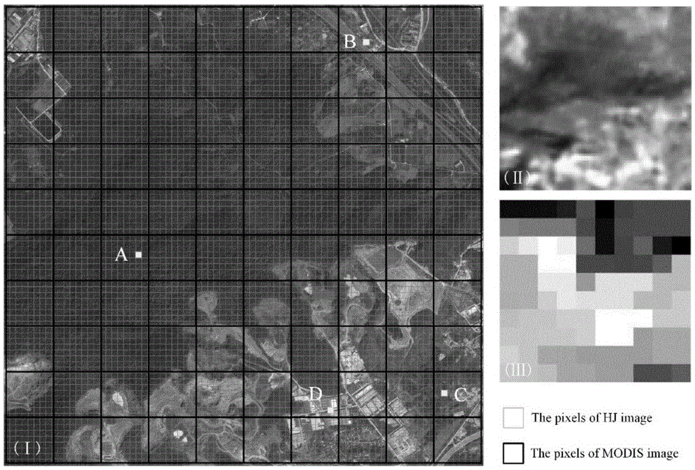
[0065] The coverage of remote sensing images used in this example is as follows: figure 2 As shown in , the study area is located in the Laoshan National Forest Park in Nanjing, China. The vegetation cover is a massive mixed forest where deciduous forest, evergreen broad-leaved forest and coniferous forest coexist. The rest of the area has land types such as bare land, reservoirs, and residential areas. This embodiment is realized by MATLABR2012a.
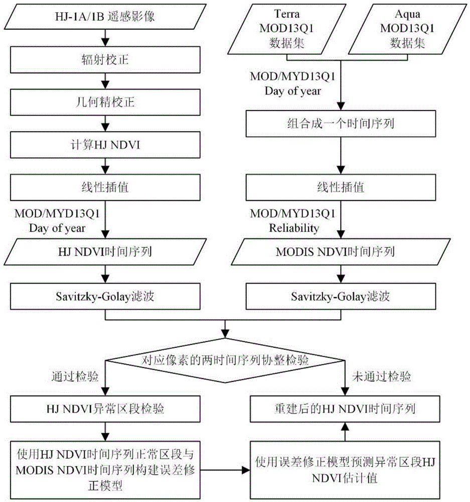
[0066] like figure 1 As shown, the MODIS remote sensing image-based high-resolution remote sensing image vegetation index time series correction method of this embodiment includes the following steps:
[0067] 1) Obtain the HJ-1A / 1B remote sensing image data of the predetermined area and predetermined time period and the MODIS remote sensing data of the same time period in the area.
[0068] The MODIS remote sensing data in this embodiment include MODISMOD13Q1 data and MODISMYD13Q1 data, first obtained from NASA (website address...
PUM
 Abstract
Description
Claims
Application Information
 - R&D
- Intellectual Property
- Life Sciences
- Materials
- Tech Scout
- Unparalleled Data Quality
- Higher Quality Content
- 60% Fewer Hallucinations
Browse by: Latest US Patents, China's latest patents, Technical Efficacy Thesaurus, Application Domain, Technology Topic, Popular Technical Reports.
© 2025 PatSnap. All rights reserved.Legal|Privacy policy|Modern Slavery Act Transparency Statement|Sitemap|About US| Contact US: help@patsnap.com